Advanced Imaging Drone
For the Birds, For the World
Description
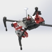
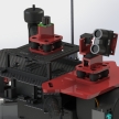
The Channel Islands National Marine Sanctuary is currently working to locate and count the endangered Marbled Murrelets in the coastal forests of Oregon. This bird species builds small nests around 300 feet up in the forest canopy, making it very difficult to track the population. The current method of carrying out this task is to send researchers to climb the trees and check locations where they believe there may be nests. This process is slow, dangerous, and overall not effective enough at monitoring the bird population. Our team is working towards developing an unmanned aerial system that can scan the tree tops for Marbled Murrelets without the need for human climbers. The project design utilizes a quad-copter equipped with a thermal camera and an obstacle detection system to provide a pilot on the ground with environmental data to facilitate flying the system through the dense canopy. The resulting system will allow researchers to collect more information about the bird population far more efficiently than currently possible. One of the inspirations for this project was to develop a fully autonomous system to scan the treetops, and we are believe that this pilot-controlled system could be used as a platform to develop an autonomous search system in the future.


